Sunday, October 23, 2011

Mile 268 to 285

Big Bear Lake from mile 277ish.
Section C
Baldwin Lake to Little Bear Springs – Nobo
Miles: 17
Hiking with: Gary B & Rob

Lodging:  Inn at Fawnskin Cabins  - There are a lot of cabins and motels in Big Bear on the south side of the lake.  I chose the little community of Fawnskin to stay in because it is on the northwest side of the lake closer to Lake Arrowhead Splinter’s Cabin and to Little Bear Springs.  Oktoberfest goes for at least a month on Big Bear with the slogan is “Party like a Local!!!”.  Evidently with marketing strategy works pretty well as the town seamed pretty full and consequently the hotel/cabin rates seemed pretty high.  We ended up paying $250/night for a 2 bed 1 bath cabin with a futon – at least it had direct TV but no Internet.  The Big Bear Best Western was $160/night and we would have needed 2 rooms so the cabin sounded pretty good.

Car Rental:  Enterprise 229 South Street, San Bernardino, CA 92401 Tel.: (909) 888-3241.  A lot of the enterprise locations is they are independently owned so you can rent a car in one location and drop it off at another without a fee.  This Enterprise rental location in San Bernardino is owned by the same guy who owns the Big Bear location so we were able to rent here and return the car in Big Bear!!!  Yahoo – that saved us about an hour on our last day!!!

Dining:  Big Bear -- Maggio’s Pizza Big Bear, CA – My theory is forget the fancy restaurants go where the locals go.  At the hotel the exec told me to go to the Peppermill which is the nicest place in town.  When I asked the front desk clerk who looked like a college student where he goes to eat he said Maggio’s – Bingo!!!  This is great Italian food at a great price.  I’ve eaten here 4 times and never been disappointed.  I had spaghetti, Calzone, Pizza, salad – it’s all great.  It’s always been full but we’ve never waited more than 10 minutes.

I’ve also eaten at “Get the Burger” in Big Bear which is a popular local Burger Joint, better than fast food, but pricey for a Burger – I’d go there again.


Start:  From Hwy 18 on the north side of Lake Baldwin (frequently a dry lake) we turned north towards the city dump on Holcomb Valley Road, a well groomed dirt road toward the City dump.  About ½ mile up you’ll see a small sign for the PCT and the trail on both sides of the road.  We parked on the side of the road. 


End:  From Fawnskin we took Rim of the World Dr north which “T”s off of the main road next to the Fawnskin Fire Station.  It is a well groomed dirt road that any vehicle could go on.  Eventually the road turns into Coxey Truck Trail.  Although maps show other roads merging and intersections we were on the only main road there was.  The road gently climbs up the mountain and then drops into the Holcomb Creek drainage.  The PCT runs next to Holcomb Creek at this point. 

People along the trail:  About mile 278 we came across 2 older couples who had enjoyed Oktoberfest the night before in Big Bear and were out for a short hike.  They were excited to get back to Oktoberfest for lunch as they have free coleslaw there – go figure. 

We also came across 20 people working on the PCT with the Big Bear Valley Trails Foundation.  My hat is off to this group making a difference on the PCT.


Description:  We got up early and drove over to the trail head.  The sun had just come up and it was a little chilly but we knew it would warm up soon.  The trail quickly ascended the mountain range north of Big Bear Lake and then hugged the back side for the first half.  There were great views to the north into the Mohave Desert.  Soon the trail crossed over to the south side of the ridge with gorgeous views of Big Bear Lake.  Then the trail slowly descended back to Holcomb Creek where we had left our car we started the previous day’s hike.  We jumped into the car, drove back to our cabin where we had arranged for a late checkout, showered (convenient before a long car ride with others), picked up the rental car, dropped off the rental car in Big Bear, ate at “Get the Burger”, and drove home to Phoenix.
Starting the hike.  We parked along side the road where the
PCT crossed.

The first ascent to the ridge line.

A view to the north into the Mohave Desert.

PCT Sign.  This is typical of the tree cover and vegetation we had all day.

A rather unusual sign placement -- in the trail.

A view NW.  The white isn't snow, I suspect it is a
surface mining operation.

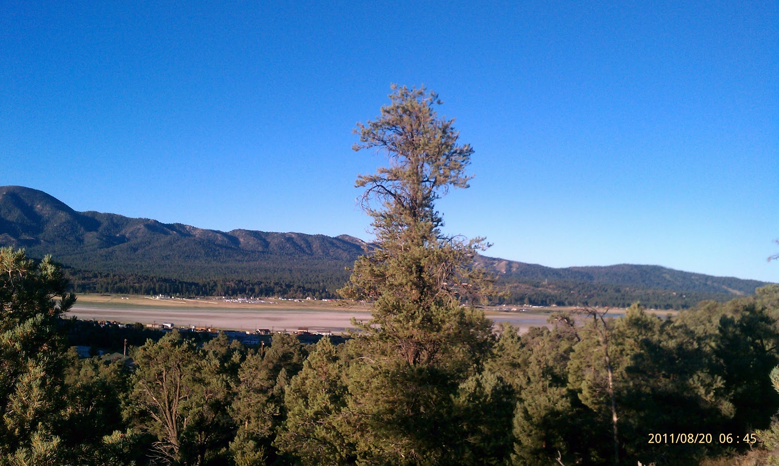
A view down at Big Bear Lake and Big Bear City on the far side.

The last 2 miles of this hike was through an old burnt section of forest.
This fire burnt all the way to Deep Creek. 

Little Bear Spring Trail Camp complete with horse corral and
picnic table. 

Gary B in front of the cabin/house we stayed in.

Saturday, October 22, 2011

Mile 285 to 298

Sorry this is not along the PCT.  Rather a view of Big Bear
Lake at Sunset from the north shore driving into town to
eat at Maggio's Pizza.
Section C
Little Bear Springs to Splinters Cabin – Nobo
Fawnskin to Lake Arrowhead
Miles: 13.5
Hiking with: Gary B & Rob

Lodging:  Inn at Fawnskin Cabins  - There are a lot of cabins and motels in Big Bear on the south side of the lake.  I chose the little community of Fawnskin to stay in because it is on the northwest side of the lake closer to Lake Arrowhead Splinter’s Cabin and to Little Bear Springs.  Oktoberfest goes for at least a month on Big Bear with the slogan is “Party like a Local!!!”.  Evidently with marketing strategy works pretty well as the town seamed pretty full and consequently the hotel/cabin rates seemed pretty high.  We ended up paying $250/night for a 2 bed 1 bath cabin with a futon – at least it had direct TV but no internet.  The Big Bear Best Western was $160/night and we would have needed 2 rooms so the cabin sounded pretty good.

Car Rental:  Enterprise 229 South Street, San Bernardino, CA 92401 Tel.: (909) 888-3241.  A lot of the enterprise locations is they are independently owned so you can rent a car in one location and drop it off at another without a fee.  This Enterprise rental location in San Bernardino is owned by the same guy who owns the Big Bear location so we were able to rent here and return the car in Big Bear!!!  Yahoo – that saved us about an hour on our last day!!!

Dining:  Lake Arrowhead – After we were done with this hike we were driving out on Hook Creek Road.  We passed a commercial area & I was looking for someplace to grab a bite.  I saw a small sign on the side of a wood planked 1 story building that said “Malt Shop”.  We turned around and went back – WOW!!!  There is a small sign on the front that said “CedarGlen Malt Shop.” This was the best place I’ve eaten at so far on the PCT!!!  This is a must stop – I had their “lowrider” burger.  Everyone agreed this place was fantastic.

Big Bear -- Maggio’s Pizza Big Bear, CA – My theory is forget the fancy restaurants go where the locals go.  At the hotel the exec told me to go to the Peppermill which is the nicest place in town.  When I asked the front desk clerk who looked like a college student where he goes to eat he said Maggio’s – Bingo!!!  This is great Italian food at a great price.  I’ve eaten here 4 times and never been disappointed.  I had spaghetti, Calzone, Pizza, salad – it’s all great.  It’s always been full but we’ve never waited more than 10 minutes.

I’ve also eaten at “Get the Burger” in Big Bear which is a popular local Burger Joint, better than fast food, but pricey for a Burger – I’d go there again.


Start:  From Fawnskin we took Rim of the World Dr north which “T”s off of the main road next to the Fawnskin Fire Station.  It is a well groomed dirt road that any vehicle could go on.  Eventually the road turns into Coxey Truck Trail.  Although maps show other roads merging and intersections we were on the only main road there was.  The road gently climbs up the mountain and then drops into the Holcomb Creek drainage.  The PCT runs next to Holcomb Creek at this point. 

End:  From Hwy 173 which loops around the east side of Lake Arrowhead take Hook Creek Rd – which is a major intersection for this area (no stop light).  Stay on Hook Creek Rd. which winds up and down and around for a while.  You’ll finally see some signs that say “Splinters Cabin” – follow the signs until you come to a locked gate with some parking to the side.  There was a storm that washed out a creek crossing so they gated the road.  From here you hike about ½ mile down the washed out road past Splinter’s Cabin to the Deep Creek Bridge and the PCT.


People along the trail:  We met 3 groups of people who were spending the weekend at Lake Arrowhead and were just out hiking.  They were all on the West end of the trail.


Description:  We had a hard time finding the trail where we parked.  The Holcomb Creek which the PCT follows ran perpendicular to the road.  It was obvious where it came in from the east but we were going to the west and didn’t see any PCT signs or trail so we hiked next to the creek assuming we’d find the trail quickly.  After about 50 yards I started looking more fervently for the trail…it was further up the northern bank of the river.  The trail must have gone north up the Coxey Truck Trail a little and then headed west.  Anyway we got on the trail and continued on.  The trail followed Holcomb Creek winding in and out of side canyons in true PCT fashion and then climbed out and over some high country before dropping down into Deep Creek Canyon where the was a very impressive hiking bridge that crossed the Canyon.  From here we exited out to Splinter’s Cabin to our car, drove back to Lake Arrowhead and ate at the Glen Cove Malt Shop (don’t miss it – see my comments under Dining), drove back to the cabin at Fawnskin, relaxed and watched a couple of Adam Sandler movies, ate dinner at Maggio’s in Big Bear, and then went to bed.

Parking area along Coxey Truck Trail and Holcomb Creek.
Gary B (red) & Rob (black).

Along Holcomb Creek. Gary B & Rob.

Taken from Deep Creek Bridge looking down Deep Creek.

Deep Creek Bridge.

Splinters Cabin.  Only the foundation remains.  Built in 1920ish.
The Cabana was built to protect the the stone walls that remain.

Rob, Me & the Rental Car at the parking area for Splinters Cabin.

Rob & Ricky Williams (poster on the wall) at the Glen Cove Malt Shop.
Good food, technology, and the PCT -- they make a great combo!!!


Friday, October 14, 2011

Mile 210 to 240.5

Mission Creek looking upstream on day 1.  The dried Yucca
Blossoms were very unique.
Section C
Heart Bar Ranch to I-10 - Sobo
Miles: 30.5 miles (2 days)
Hiking with:  Solo

Lodging:  None
Car Rental:  None
Dining:  None

Start:  We took Hwy 38 north from Redlands to Heart Bar State Park.  We turned south off the road and at the “Y” we took a right and drove for about 30 minutes.  There was a PCT sign and a wide bend where the PCT crossed the road. 

End:  I-10.  Off of I-10 take the Haugen-Lehman Way exit 110 which is right before the Hwy 111 exit to Palm Spring if you’re coming from LA.  Go to the north side of I-10 and turn left on Tamarack Road.  About 100 yards past the last house on your left you’ll be able to see where the dry river bed goes under I-10 (this is a big overpass – you can’t miss it).  This is where the PCT goes under I-10 and you should be able to see the trail on both sides of the road.  I understand that cars left unattended here will get towed!!!  If you have to park go further north at mile 111.5 where the PCT crosses Desert View Rd where there is a parking lot. 

People along the trail:  None.  However they were other car campers at the Whitewater WildernessPreserve.  A couple of old ladies came over to my tent as told me they were Christians – I told them I was hiking all day.  I was as interested in their religion as they were about my hiking.  Boring.

Description:  My two boys (23 & 15) decided they wanted to do Disneyland and so I had them shuttle me.  They dropped me off about 10 pm in complete darkness.  They looked a little concerned as their dad hiked off into the darkness by himself – that probably lasted about 30 seconds and then they were worried about finding their way back to civilization on this dirt road.  I hiked about ½ mile until I got to Mission Springs Camp at mile 239.  About 200 yards away were two springs so I thought I would hear animals all night – not a one.  I was up before sunrise, packed up camp, ate breakfast and was on the trail before the sun came up although the sky was blue – perfect.  The trail rapidly descended from the alpine forest down mission creek down to a large wash.  The trail follows a spectacular desert stream for a long ways.  About 1:30 pm at mile 226 it was getting pretty hot so drenched myself with water and napped under a tree for about an hour.  It was the ideal spot as shortly after the trail steeply climbed up a ridge and then descended into the Whitewater River drainage.  At about 4 pm and mile 220 I stopped in the shade next to the river and drenched myself again and cooled off another 15 minutes before I completed the day’s journey to the Whitewater Wilderness Preserve.

The Whitewater Wilderness Preserve is pretty impressive.  They have tap water, nice bathrooms, picnic tables and grass to camp on.  There is signage from the PCT to the preserve ½ mile away.  I guess the old owners weren’t friendly to PCT hikers – these guys were great. 

I was up before the sun the next day, packed my tent, ate lunch, used the restrooms, and on the trail with my headlamp.  The sun was up within 10 minutes.  The trail was very different today as it climbed out of the desert wash and up through the neighboring mountains.  There were horse tracks on the trail and what I thought were mountain lion tracks (I’m sure it was just a big dog following the horse).  After a while I popped over a saddle and was hiking alongside a windmill farm – maybe this stops air pollution but they make up for it in noise pollution.  About 2.5 miles from I-10 the terrain opens up and you hike around the little community to get to I-10.  My boys were supposed to pick me up at 10 am but had slept in (who would have thought).  I camped out in the shade of the I-10 overpass for 30 minutes until they arrived.  We cruised back to Phoenix. 

This was my first PCT solo hike.  I’ve solo hiked once before and find it very peaceful.  It is also very efficient as you can stop and start when you want and hike at your own pace.  My biggest worry is getting lost but with maps and my GPS I feel very confident. 
A red sky as the sun rises early in the morning near Mission Springs Camp.

My backpack at Mission Springs Camp.

Unusual dried Yucca blossoms along Mission Creek.

Mission Creek.

A look down at Mission Creek as the trail ascends over a ridge to Whitewater River.

The first view of Whitewater River.

A large heard of Mountain Goats just above Whitewater River.

Signs at the Whitewater Preserve and the PCT junction.

Whitewater Perserve's bridge & trail leading to their facility.

Whitewater Preserve camping area -- free for hikers!!!

A trout pond at Whitewater Preserve.

Sunrise on the mountains on day 2.

Windfarm along the PCT.

Trail sign at the beginning of Section "C".

Friday, September 16, 2011

Mile 118 to 152

Looking down at Hemet Valley at sunrise from mile 119.
.Section B
Lost Creek Road to Hwy 74 - Nobo
Miles: 34 miles (2 days)
Hiking with: Sam “Hatchet”

Lodging:  Warner Springs Ranch Resort before the hike and camped the 2nd night.  Warner Springs Resort, Warner Springs, CA.  Ok…I manage hotels so I look at hotels differently than most people.  Nothing bothers me more than hotel employees that act like they wish you weren’t there but I will try and be objective with Warner Springs.  I’ve stayed here two different times while hiking the PCT.  Both times I called the hotel several times and was never able to talk with someone who would reserve a room for me – I know it doesn’t sound credible but it’s true.  Both times I finally gave up and booked the room on Expedia – which I hate to do because I know that 30% of what I’m paying will go to Expedia as a commission where I would prefer it to go to the hotel.  Both times upon arriving they were very friendly at the front desk and at the front gate.  Both times we stayed in the older Casitas which were spacious but a little run down (Super 8 quality bed/bath/carpet - older & worn).  For $106/night in the middle of nowhere I would say this is an OK deal.  About 1 week after my stay I got a letter in the mail from the Warner Springs Resort that was a receipt for a $10 “resort fee”.  This is fraud – if they were going to charge me a “resort fee” they should have told me when I checked in.  I called the hotel politely about 3 times with promises of getting a return call from the person that handles this – no call back.  Finally I called my credit card company and told them I did not approve the charge and they removed it from my bill - which means they will suck the $10 back out of the Warner Springs Resort’s bank account.  Would I stay there again – yes, but I’m irritated because they could be so much better and there is no other hotel within 45 minutes. 


Car Rental:  Avis - Palm Springs Int’l Airport.  I like Avis.  I rent from them often and they treat me well.  The reservation was for a full size car ($50) and the guy at the Avis desk asked if I wanted a 2 or 4 door.  I said “I don’t care.”  He gave me a screaming red Mustang – what fun on those curvy mountain roads!!!

Dining:  Fishermen’s Market & Grill, Palm Springs.  This had great affordable seafood and has been featured on the TV Food channels.  There is also one in Banning – I’ve eaten at both and they are both excellent.  Try their shrimp tacos – mmm.

Paradise Valley CafĂ©, Hwy 74 & Hwy 371.  Popular because it’s the only cafĂ© within a 30 minute drive & their burgers are great.  I had one with green chilies on it…ymmm.


Start:  We drove a car up Lost Creek Road (paved) and watched the GPS to where the trail came the closest to the road.  There happened to be a pullout on the roadside where we parked and there was a faint trail leading up to the trail 30’ uphill.  This was at mile 118.

End:  Where the PCT crosses Hwy 74 (Palms to Pines Hwy).  There is a PCT sign visible from the road and good size parking lot on the north side of the road.  At mile 152.

 People along the trail:  We saw no other hikers for 2 days.

Description:  This section is in the high desert with very little shade and elevations between 4,000’ and 5,000’.  Summer would be brutal as there was limited water.  Fall through Spring would be optimal for this hike.  The trail winds up, down and around small mountains and canyons.  This is a pretty hike.  We filled up with water at a cache at Chihuahua Valley Road (mile 127) and wrote our names in the log book.  Only ½ mile away is a house that hikers usually get water from – but I don’t want to hike an extra mile so we forge northward.  We were running low on water towards the afternoon and thought we would find a stream but they were all dry.  Finally we came to Tule Canyon which had a trickle through yucky green stuff.  So we kept hiking down to where the map said the best source was.  When we got there we say a new cement water tank that must have been installed within the last month.  About 15 yards away from the tank was a fire hydrant with a wrench sitting on it.  We cranked the wrench and much to our disgust out came some terrible looking rusty orange water.  Patience I thought…finally after about 3 minutes the water cleared so we started filtering.  It was respectable tasting water.  About 30 minutes after sunset we set up our tents in a small campsite alongside the trail at mile 143 where there was another water cache and then we fell asleep to coyote calls. 

Rising before the sun we had our tents packed and ate breakfast as the sun came up over the horizon.  Shortly after that we were on the trail with only 10 miles to go.  This last stretch was must more interesting than the previous day as we hiked through large boulders as we ascended a mountain and then went into and out of Alkali Wash which looks like the extreme desert north of Palm Springs.  Soon we were back to the car on Hwy 74.  We drove down to the Paradise Valley CafĂ© for an early lunch (great Burgers), picked up the car on Lost Valley Road, returned the Mustang to Avis at Palm Springs Airport, and cruised home to Phoenix.
Sam "Hatchet" along the trail.  Scenery typical of the first day.

A burnt section of trail. 
This would have been the only stand of trees along this section. 

Sam "Hatchet" next to the mother
lode of water next to Tule Springs. 

A view looking south into Tule Canyon.

A tarantula!!!

Red Mustang -- guaranteed fun before and after hiking!!!
At the Hwy 74 parking lot at mile 152.

Saturday, August 20, 2011

Mile 255 to 268

Sunrise about mile 267.
.Section C
Baldwin Lake to Deer Spring Camp
Miles: 13
Hiking with: Gary

Lodging:  Best Western in Big Bear, CA.  This is the only “chain” hotel in Big Bear and besides I manage some Best Westerns so I get a discount – so I’m staying here.  Prices are high in Big Bear – you may find a better deal elsewhere but the Best Western was quaint with great beds, cable tv, internet & a great breakfast (not so with a cabin or home rental)! 

Car Rental:  Enterprise Car Rental Big Bear, CA  It was nice to rent close to the trailhead but at a cost.  They didn’t open until 8 am and were closed on Saturday and Sunday.  So I got it Friday morning and returned it Saturday afternoon in their lot and got charged for Sunday… I’m ok with that.  It was a Nissan compact that cost me $40/day and went incredibly fast on the dirt roads and I only scraped the bottom once (the beauties of a rental).

Dining:  – Across the street and up a little bit from Maggio’s Pizza (my first choice) is “Get the Burger” which is a popular local Burger Joint, better than fast food, clean, but pricey for a Burger – I’d go there again.

Start:  From Hwy 18 on the north side of Lake Baldwin (frequently a dry lake) we turned north towards the city dump on Holcomb Valley Road, a well groomed dirt road toward the City dump.  About ½ mile up you’ll see a small sign for the PCT and the trail on both sides of the road.  We parked on the side of the road. 

End:  Off of Hwy 38 we took Forest Road 2N01 to the east.  There are very few roads off of Hwy 38 – especially on the east side and the terrain drops off quickly.  About 0.5 mile down the dirt road is a dry creek, park in the small parking area to the left (3 cars), and the PCT crosses the road at mile 255 about 0.5 miles before the PCT comes to deer springs and a trail camp.

Permit Required:  You need an adventure pass to park anywhere in the southern California National Forests which is $5/day or $30/year (I never used one south of I-10 and never had a problem but I’d just by 2 annual passes and be done with it).  We got our pass at the Big Bear Walgreen’s and at the B&B where we stayed another time or you can get one online – which may be easier.

 People along the trail:  We saw no other hikers.

Description:  We started this hike in the dark but within 10 minutes the sky was blue and the sun just creaking up over the horizon.  This is the best time to hike with great lighting for photographs.  I always say that miles before 10am are zero miles – by 10 am you still feel fresh even though you’ve done 10 miles.  If you started at 10 am and hiked 10 miles by 3 pm you’d be tired.  It’s something about the cool air & low angle of the sun that makes the miles easier.  The first part is a great stretch of trail is on the edge of the mountains with little tree cover and great views to the Mohave Desert below.  Soon the trail curves into the mountainous terrain and follows a pretty little canyon with a small stream up to Deer Spring Camp and then to the car.  We were done by noon, drove back to get the other car, dropped it off at Enterprise Car in Big Bear, ate at Get The Burger, and cruised back to Phoenix taking Hwy 18 down the north side of Big Bear (if you’re heading to Phoenix this is a great alternate drive back rather than I-10 again).
The rare Joshua Tree -- unusual to see one at 6,500'.

I couldn't figure this sign out --
are we supposed to step on vegetation?

A little trail magic lefy by the Big Bear Hiker's Hostel
where the trail crosses Hwy 18.

A little disposal service provided by a the Big Bear Hiker Hostel.

A view SW at Baldwin Lake (dry) and Big Bear City.

Friday, August 19, 2011

Mile 240.5 to 255

At the day's trailhead.
.Section C
Heart Bar Ranch to Deer Spring Camp - Nobo
Miles: 14.5
Hiking with: Gary

Lodging:  Best Western in Big Bear, CA.  This is the only “chain” hotel in Big Bear and besides I manage some Best Westerns so I get a discount – so I’m staying here.  Prices are high in Big Bear – you may find a better deal elsewhere but the Best Western was quaint with great beds, cable tv, internet & a great breakfast (not so with a cabin or home rental)! 

Car Rental:  Enterprise Car Rental Big Bear, CA  It was nice to rent close to the trailhead but at a cost.  They didn’t open until 8 am and were closed on Saturday and Sunday.  So I got it Friday morning and returned it Saturday afternoon in their lot and got charged for Sunday… I’m ok with that.  It was a Nissan compact that cost me $40/day and went incredibly fast on the dirt roads and I only scraped the bottom once (the beauties of a rental).

Dining:  Maggio’s Pizza  Big Bear, CA – My theory is forget the fancy restaurants go where the locals go.  At the hotel the exec told me to go to the Peppermill which is the nicest place in town.  When I asked the front desk clerk who looked like a college student where he goes to eat he said Maggio’s – Bingo!!!  This is great Italian food at a great price.  I’ve eaten here 4 times and never been disappointed.  I had spaghetti, Calzone, Pizza, salad – it’s all great.  It’s always been full but we’ve never waited more than 10 minutes.

I’ve also eaten at “Get the Burger” in Big Bear which is a popular local Burger Joint, better than fast food, but pricey for a Burger – I’d go there again.


Start:  From Big Bear we took Hwy 38 south to Heart Bar State Park.  We turned south off the road and at the “Y” we took a right and drove for about 30 minutes.  We passed some parked cars at a trailhead about 2/3rds of the way up.  There was a PCT sign and a wide bend where the PCT crossed the road.  We parked on the edge of the road.  We probably should have parked another 0.5 miles up the road at mile 240 where there is a camping area and lots of parking. 

End:  Off of Hwy 38 we took Forest Road 2N01 to the east.  There are very few roads off of Hwy 38 – especially on the east side and the terrain drops off quickly.  About 0.5 mile down the dirt road is a dry creek, park in the small parking area to the left (3 cars), and the PCT crosses the road at mile 255 about 0.5 miles before the PCT comes to deer springs and a trail camp.

Permit Required: You need an adventure pass to park anywhere in the southern California National Forests which is $5/day or $30/year (I never used one south of I-10 and never had a problem but I’d just by 2 annual passes and be done with it). We got our pass at the Big Bear Walgreen’s and at the B&B where we stayed another time or you can get one online – which may be easier.


People along the trail:  We crossed paths with a couple who was section hiking.  They had driven up Coon Creek Road to the PCT about mile 246.5.  It was probably a better road than we took but it would have made our hike too short.

 Description:  We left Thursday after work and arrived at Big Bear late at night.  We got up and ate breakfast at the hotel and arrived at Enterprise Car Rental when they opened by 8 am (see notes above).  It took about an hour to get to the trailhead and we’re quickly on the trail.  The trail stays in the pines the whole way but true to the dry mountain west it got warm when you were in the sun.  There were some great views into the desert from Coon Creek Jumpoff at mile 246.5 – Jumpoff is very descriptive.  Next we crossed a dirt road and saw the “AnimalCages” as listed on Halfmile’s maps and the USGS Topo maps.  The PCT comes within 50 yards of the cages.  I could see 4 bears in cages – one gave a good growl that echoed in the forest and would have had me running if I didn’t see the cages.  These animals are used in photoshoots and movies.  At mile 252 there is a dirt road that leads out to Hwy 38, about 50 yards away.  Here there is a Water Cache and a card for a hiker’s hostel and shuttle to Big Bear.  Soon we came to our car, drove back to pick up the rental car from our trailhead, returned and dropped off the rental car on Forest Road 2N01 where we finished our hike that day.  We returned to the hotel, showered and had a great dinner at Maggio’s. 
PCT

"Animal Cages" The fuzzy brown thing in the center is a bear.

Looking south at San Gorgonio Mountain.

Nice wildflowers to add color.