Tuesday, May 31, 2011

Mile 110 to 118

Gary hiking through the flowered meadow close to
Warner Springs Resort.  We started Sobo in the mountains
in the background.
Section B
Lost Creek Road to Warner Springs - Sobo
Miles: 8
Hiking with: Gary Driggs

Lodging:  Warner Springs Resort, Warner Springs, CA.  Ok…I manage hotels so I look at hotels differently than most people.  Nothing bothers me more than hotel employees that act like they wish you weren’t there but I will try and be objective with Warner Springs.  I’ve stayed here two different times while hiking the PCT.  Both times I called the hotel several times and was never able to talk with someone who would reserve a room for me – I know it doesn’t sound credible but it’s true.  Both times I finally gave up and booked the room on Expedia – which I hate to do because I know that 30% of what I’m paying will go to Expedia as a commission where I would prefer it to go to the hotel.  Both times upon arriving they were very friendly at the front desk and at the front gate.  Both times we stayed in the older Casitas which were spacious but a little run down (Super 8 quality bed/bath/carpet - older & worn).  For $106/night in the middle of nowhere I would say this is an OK deal.  About 1 week after my stay I got a letter in the mail from the Warner Springs Resort that was a receipt for a $10 “resort fee”.  This is fraud – if they were going to charge me a “resort fee” they should have told me when I checked in.  I called the hotel politely about 3 times with promises of getting a return call from the person that handles this – no call back.  Finally I called my credit card company and told them I did not approve the charge and they removed it from my bill - which means they will suck the $10 back out of the Warner Springs Resort’s bank account.  Would I stay there again – yes, but I’m irritated because they could be so much better and there is no other hotel within 45 minutes. 

Car Rental:  Hertz Car Rental – Imperial County Int’l Airport, El Centro, CA

Dining:  Warner Springs Golf Grille, Warner Springs CA.  This was OK.  During slow times at the Warner Springs Resort this is the only restaurant open for lunch.  We never ate dinner or breakfast at the resort.

Start:  We drove a car up Lost Creek Road (paved) and watched the GPS to where the trail came the closest to the road.  There happened to be a pullout on the roadside where we parked and there was a faint trail leading up to the trail 30’ uphill.

End:  Mile 110 at Hwy 79 near Warner Spring Resort.  A PCT sign is posted alongside the road and the shoulder is extra wide to allow for cars to park alongside the road.  We were the only car when we parked early in the morning (sunrise) but when we picked up our car around 10 am there were 4 other cars parked there.

People along the trail:  We saw no an ex-through hiker at CS115 (Camp Site at mile 115).  There were a group of Australians attempting an ambitious through hike – 30 miles/day.  I never met the group but had heard they were very macho – ex-ironmen/women.  The hiker we met at this campsite was ripped (no fat – lots of muscle).  He said he had enough of hiking every day that he was just going to tour around the west coast and hike in certain areas.  In my opinion it was impressive he came this far.  It seems that through hiking and long distance hiking takes a certain type of patience and mental preparation and is not for everyone.

Description:  We were initially going to drive to the PCT on Chihuahua Valley Road but the road was blocked off.  This would have put us at mile 127 which would have been a perfect distance after a long 20 miles from Fuller Ridge to I-10 the previous day.  However there was a locked gate on the road and a no trespassing sign which we obeyed.  After looking at the maps and reading Shem’s book a little more I think there is a way around this as Chihuahua Road is very well maintained where it crossed the PCT at mile 127.  So came down to Lost Valley Road and started at mile 118 which shortened our hike to 8 miles. 

This was an interesting stretch of trail as it transitioned from the high desert to the lower flowering meadows common around Warner Springs.  Within 2 miles the trail crosses the Agua Caliente Creek and from this point on you’re never too far from water.  Once we crossed Hwy 79 we went through a large field of stomach high yellow flowers  with lots of bees….no worry though as the bees were occupied with the blossoms and paid no attention to us temporarily interrupting their feast.
Desert flowers were still blooming late in the Spring.

Gary crossing Agua Calienta Creek.

Some type of agave plant.

There were huge oak trees along the creek. 
I think Warner Springs Resort uses this area for group cookouts.

Monday, May 30, 2011

Mile 190 to 209

Ice covered pine needles at
Fuller Ridge Trailhead.
Section B
Fuller Ridge to I-10 Nobo
Miles: 9
Hikers: Dan & Gary

Lodging:  Holiday Inn Express Banning, CA  

Car Rental:  Hertz Car Rental – Palm Spring Int’l Airport (car rentals from airports are easier as they are usually open later in the evening and through the weekend).

Dining:  Fisherman’s Market & Grill, Banning, CA.  This had great affordable seafood and has been featured on the TV Food channels.  There is also one in Palm Springs – I’ve eaten at both and they are both excellent.  I had their shrimp tacos – mmm.

Start:  At Fuller Ridge Camp Site.  From I-10 take Hwy 243 towards Idylwild.  Turn left onto Black Mountain Trail (Forest Route 4S01) which is a well maintained dirt road with some short patches of pavement and go for a good 30 minutes.  Another road merges with Black Mountain Trail about a third of the way up, but other than that just stay on the road.  Eventually you’ll see a sign for Black Mountain Group campsite…keep going. About another mile up you’ll actually cross the PCT – although I don’t recall any signs visible from the road.  There is a dirt road on the right with a sign for the Fuller Ridge trailhead.  There is lots of parking and both times I was at this trailhead someone was camping here (not PCT hikers). 

End:   I-10.  Off of I-10 take the Haugen-Lehman Way exit 110 which is right before the Hwy 111 exit to Palm Spring if you’re coming from LA.  Go to the north side of I-10 and turn left on Tamarack Road.  About 100 yards past the last house on your left you’ll be able to see where the dry river bed goes under I-10 (this is a big overpass – you can’t miss it).  This is where the PCT goes under I-10 and you should be able to see the trail on both sides of the road.  We drove back to the last house and paid them $20 to park in their gravel yard.  They were very accommodating.  I understand that cars left unattended here will get towed!!!  Another option would be to go further north at mile 111.5 where the PCT crosses Desert View Rd where there is a parking lot.  It just makes this hike a ½ hour longer but will assure you of have a car there when you arrive.

People along the trail:  I saw more rattlesnakes (1) than hikers.  The snake was in the middle of the trail just sunning and quickly slithered off the trail to let us pass.  After we descended the San Jacintos just after the drinking fountain at WR206 we saw a pickup truck with a swamp cooler in the back bed blowing air into the cab.  We stopped and talked to the occupant who was a security guard for the water facility further up the canyon.  He had a few books in this truck – a necessity for his occupation.
Description:  I would usually stay clear of the desert from May through September but it was a cooler than normal weekend.  As we drove into Palm Springs the wind was blowing and it sprinkled a little.  The plan was to drive up to the trailhead that night and sleep in the car so we could be on the trail at sunrise however the glowing Holiday Inn Express sign along the highway drew us in as we opted for a comfy bed over sleeping bags.  We woke up before dark and enjoyed a nice hotel breakfast and drove about 40 minutes to the Black Mountain turnoff and then headed up another 30 minutes to the trailhead.  It had rained here during the night and there was a coat of ice on the pine trees – glad we opted for the hotel.  At first we were in very large pine trees with huge pine cones but we rapidly dropped out of the trees where we were exposed to the sun and the unbelievable vistas.  For being so close to I-10 I thought we’d be looking at it all day but we were mostly looking back at the San Jacinto’s.  This is similar to hiking down the Grand Canyon where you have nonstop views because of the lack of vegetation and the vertical descent.  There was no water on this section until you got off the mountain at mile 206 where they have tapped into the public water supply and installed a drinking fountain & faucet.  The trail starts at 7,500’ elevation and at the mile 206 (16 miles into the hike) you are at 1,500’ elevation – that’s a lot of down.  Now comes the last 4.5 miles through a sandy river bottom in the hot afternoon desert sun….ugh.  You quickly pass the small housing community of Snow Creek and start wandering through the desert.  The trail wasn’t marked very well here although if you got off the trail and just kept walking in the river bottom you’d eventually see I-10 and the underpass where the trail goes.  This was the most wearing hike so far because of the vertical descent and the sun/heat of the desert (even though it wasn’t over 90 degrees).  We finally got to the underpass and there were 2 coolers filled with ice and sodas and beer!!!!  A sign above it said “for PCT hikers.”  I love trail angels.
An ice covered pine tree at Fuller Ridge Trailhead.

A blooming Agave (Century Plant) with
Mt. San Jacinto in the background.

Wild flowers along the trail.


A rattlesnake guarding the trail.

Gary enjoying the generosity of trail angels.

Saturday, April 23, 2011

Mile 58 to 77.5

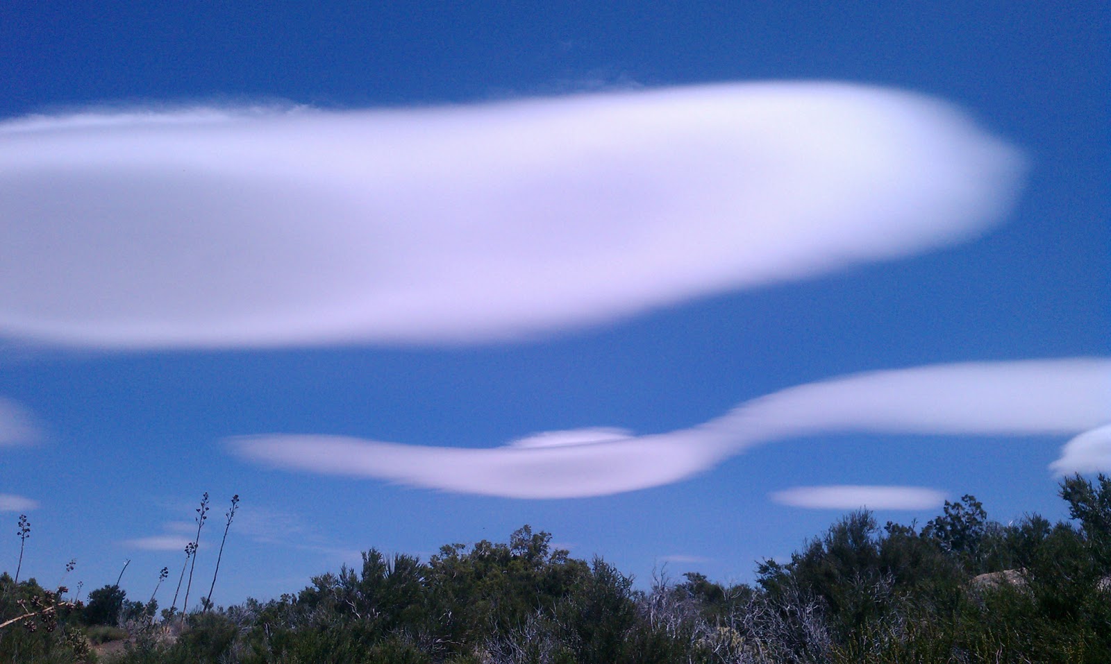
Unusual wind swept clouds over the Anza Borrego Desert.
Section A
The most northern access to the PCT along Sunrise Hwy to Scissors Crossing - Nobo
Miles: 19
Hikers: Dan & Gary

Lodging:  Mt. Laguna Lodge

Car Rental:  Hertz Car Rental – Imperial County Int’l Airport, El Centro, CA

Dining:  Subway in El Centro, CA 

Start:  From Mt. Laguna Lodge we drove north on the Sunrise Hwy parking where Deer Park Road (don’t be deceived by the term “Road” as it looks more like a dirt driveway that is gated) joins the Sunrise Hwy on the west.  To access the PCT you must cross the road (Hwy) which is at the edge of a drop off and scramble down a moderately steep rough path about 30’.

End:  The previous night we dropped of a car at Scissors Crossing which is at mile 77.5 on the PCT or where County Hwy 3 cuts across Hwy 78.  On the north side of Hwy 78 on County Hwy 2 there is a large shoulder where we parked our car.  While we were the only car there at night there were 3-5 cars parked during the day.

People along the trail:  The PCT sign is something every hiker looks for – it confirms you are on the right trail and means you won’t have to retrace your steps and add more miles to your already long hiking day.  One thing I have noticed that under the PCT signs they either have illustrations or spell out “no motorized vehicles, no mountain bikes”.  The PCT does allow horses – the horse world was very instrumental in passing the original PCT legislation through Congress.  So…we came across about 5 through hikers just cleaning camp at mile 64.  Of course we stopped and chatted with them for a few minutes and then we were on our way.  The trail continues up a jeep trail.  I’m a faster hiker than Gary so I motored on ahead.  About 0.125 miles up the hill I saw a faint trail split off the road with a sign but no PCT logo so I continued up the road another 100 yds to a flat spot to wait for Gary.  From this flat spot I could only see 10 yards down the trail/road as it curved and there were some bolders blocking the view.  After 5 minutes… no Gary.  I checked my GPS and found that the faint trail was the PCT.  I hiked back down and took the faint trail (PCT) and checked my GPS – yes this was the trail.  Still no Gary so I hiked back to see if Gary had made it up the hill yet.  When I got back… still no Gary so I wait another 5 minutes.  By this time I know Gary would have made it up the hill so I figured he either made the correct turn on to the faint trail (PCT) and I missed him or he missed the faint trail and continued up the road while I was on the faint trail (PCT).  Gary is an extremely logical and experienced hiker so I assumed he took the faint trail (PCT) so I started jogging to find him.  After about 0.5 miles I saw him up ahead and started walking to catch up to him.  I turned back to look where the trail split and the through hikers we passed 15 minutes ago missed the turn-off too.  I yelled to get their attention – no response.  They will eventually figure out they're were off the PCT.  After catching Gary I quizzed him why he took the unmarked trail he said "it didn't have the PCT logo but it said 'no mountain bikes' so I took it".  Very smart.  I learned an important lesson today… always wait at trail crossings for your whole party.

 Description:  As we drove to the trailhead there were spectacular wind swept clouds with the sun coming up – it was spectacular.  The trail drops off the Mt. Laguna rim into the Anza Borrego Desert.  After Rodriguez Canyon the desert really gets pretty.  I’m a desert expert having lived in Arizona for 25 years.  If you hike this section in mid-late April you will see unbelievable cactus blossoms (check out my photos below).  This is really the only true desert portion of the PCT between the Mexican Border and Big Bear (most people look at barren land and call it desert but it’s the plants/cactus that truly define a desert).

We finished about 5 pm, jumped into the car left the previous day and drove back to pick up the other car, dropped of the rental car in El Centro, ate at Subway, and cruised back to Phoenix.
PCT lined with desert flowers.

Indian Paint Brush.

Hedge Hog Cactus

Long Horn Cactus.  It is actually considered a green blossom.
I would call it YELLOW/green.  But technically it is the only plant with a green blossom. Hmmm....

A rare type of Prickley Pear Cactus.
Most are greener and have yellow blossoms.
A little PCT Graffiti/humor left by previous hikers I presume.

Water Cache left by a trail angel. 
This is in the middle of a 30 mile dry stretch of the PCT.
Day hikers should appreciate the trail magic but not partake.
Day hikers can carry enough water for the day.  Leave the Water Caches for the through hikers.

Friday, April 22, 2011

Mile 41.5 to 58

Section A
Mt. Laguna to most northern access to the PCT along Sunrise Hwy - Nobo
Miles: 17
Hikers: Dan & Gary

Lodging:  Mt. Laguna Lodge

Car Rental:  Hertz Car Rental – Imperial County Int’l Airport, El Centro, CA

Dining:  We went to the trail town of Julian and ate at Romano’s Dodge House which was recommended by a local -- good advice.  It had great Italian food and was moderately priced.  We returned and ate here on our next trip to Julian.  Also a must do is Mom's Pies -- written up by the Food Network Shows. 

Start:  We drove back to the Burnt Rancheria Campground – last time we were here in early April it wasn’t open, this time it was.  We found the Campground Hosts, paid for a day use permit and parked the car about 30 ft. from the PCT where we started Sobo last time.  This time we are going Nobo.  If you’re wondering if the snow has melt on Mt. Laguna before you do your hike look at the USD webcam ontheir Observatory. 

End:  We drove the rental car north on the Sunrise Hwy.  My goal was to get as far north as possible to make the next day’s hike shorter.  We ended up parking where Deer Park Road (don’t be deceived by the term “Road” as it looks more like a dirt driveway that is gated) joins the Sunrise Hwy on the west.  To access the PCT you must cross the road (Hwy) which is at the edge of a drop off and scramble down a moderately steep rough path about 30’.  The PCT in this section is below the edge and below the road and you cannot see the road or your parked car!!!  Make notes of the surroundings and mark this spot on your GPS.  We would leave the car overnight and return to the Laguna Mtn Lodge for the night. 

People along the trail:  We encountered about 8 PCT through hikers as this is prime time for through hikers.  We also came across a trail crew working on the PCT.  These were older guys (I’m 52 and consider myself young).  Each one of these guys could have taken me down in a heartbeat.  One guy (I forgot his trail name) was an ex-marine, 68, and had done the PCT several times, AT (Appalachian Trail) & CDT (Continental Divide Trail) – last year on his PCT through hike he averaged 30 miles/day.  This guy was tough.  These trail veterans were giving back.  It seems like there is a close knit group of hikers that through hike – they all know each other, have heard stories of each other, and they help each other out – the PCT Family.  This was my first encounter with “Trail Angels”, someone helping others without any expectation of a “thanks”.

Description:  This trail follows the edge of the Plateau atop Mt. Laguna.  On the east the terrain drops down into the desert.  The cool breeze from the west was blowing strong but with the sun out it was a rather nice day.  This was a relatively “flat” hike with no big ups or downs but the trail continually was going up or down.  I should say more but it was basically great views into the Anza Borrego Desert all day. 

We finished about 5 pm, jumped into the car left the previous day and drove back to the Burnt Rancheria Campground to pick up the other car.  We then dropped a car at tomorrow’s trail end at Scissors Crossing (mile 77), drove to Julian – a very charming tourist town known for their apple pies, at dinner at Romano’s Dodge House which was recommended by a local.    It had great Italian food and was moderately priced.  We returned and ate here on our next trip to Julian too.  After dinner we returned to Mt. Laguna Lodge for the night.
USD Observatory -- check out it's webcam to see what the weather is like at Mt. Laguna.

Looking down into the Anza Borrego Desert.  Typical of the view all day long.

Sign along the PCT which goes on the Pioneer Mail Trail a short ways.

The wind was howling...
I thought we were going to get blown down to the desert.
A windy but beautiful day.

Sunday, April 17, 2011

Mile 101 to 110

There were endless fields of flowers on this hike.
Section A
Warner Spring to Barrel Springs - Sobo
Miles: 9
Hikers: Dan, Chris & Gary

Lodging:  Historical House Lodging, Julian, CA – Try another B&B as this place had a bath tub, no shower.   

Car Rental:  Hertz Car Rental – Coachella, CA

Dining:  Julian, Ca at Romano’s Dodge House which was recommended by a local.   It had great Italian food and was moderately priced.  We also got a couple of apple pies to take home to the family from Mom’s Pies.  This is a must stop as it’s been featured on the TV Food Networks before. 

Start:  Mile 110 at Hwy 79 near Warner Spring Resort.  A PCT sign is posted alongside the road and the shoulder is extra wide to allow for cars to park alongside the road.  We were the only car when we parked early in the morning (sunrise) but when we picked up our car around 10 am there were 4 other cars parked there.

End:   Barrel Springs on the south side of County Hwy S22.  There is a lot of space to park next to the road.

People along the trail:  We saw only one group of 5 going Nobo.  We also crossed paths a couple of horseback riders on the trail.  The PCT is for hikers, pack animals and horses.

Description:  We opted for this section of trail rather than hiking 20 miles south of Scissors Crossing because we were beat from doing the 24 mile section south of here from Barrel Springs to Scissors Crossing (it was a little hot too).  If we had more energy I would have started this hike at Barrel Springs and hiked 8 miles past Warner Springs.  The trail from Barrel Springs to Warner Springs is fairly exposed, and the 8 miles north of Warner Springs has occasional shade as well as nearby water most of the time.

This is a great section of trail with gentle rolling hills loaded with flowers and grasses.  Although we saw a lot of blossoms, it was probably greener about 2-4 weeks earlier in the year.  There is something magical about walking through large fields of flowers – it reminds me of Dorothy dancing through the poppy blossoms in the Wizard of Oz. 

Eagle Rock is a must-see 20 yard detour located in the middle of rolling grasses.  It is a rock outcropping (unusual for this trail) that looks like an eagle.  Hiking Sobo you couldn’t really see the eagle until you were looking at it from the Nobo direction.  There were chuckwallas and the black lizards all over the rocks.
Gary (L - father-in-law)
Chris (R - Gary's grandson & my son)
3 generations on the trail at once!!!

Chris riding Eagle Rock.

California Poppies.

Chris hiking on the flowered PCT.

Horses on the PCT.

Saturday, April 16, 2011

Mile 77 to 101

Barrel Springs.
Section A
Barrel Springs to Scissors Crossing - Sobo
Miles: 24
Hikers: Dan, Chris & Gary

Lodging:  Historical House Lodging, Julian, CA – Try another B&B as this place had a bath tub, no shower.   

Car Rental:  Hertz Car Rental – Coachella, CA

Dining:  at Romano’s Dodge House which was recommended by a local.    It had great Italian food and was moderately priced.  We also got a couple of apple pies to take home to the family from Mom’s Pies.  This is a must stop as it’s been featured on the FoodNetwork before. 

Start:  Barrel Springs on the south side of County Hwy S22.  There is a lot of space to park next to the road. 

End:  As we drove from Julian to Barrel Springs we dropped our 2nd car at Scissors Crossing.  We were the only car at the time, but when we finished there were 4 cars parked next to the road.

People along the trail:  This section was typical PCT trail.  The trail initially climbed up to 4,000’ and then stayed close to that level all day long as the trail wound in and out of canyons.  The trail appeared to stay on what seemed like a Topo Map contour line.  There wasn’t a spot that didn’t have a great view, but even a great view all day long gets old after a while.  Chris, my son who has done the Grand Canyon several times with me, commented “I’m not sure I like this long distance hiking.”  Hiking the Grand Canyon is hard but you’re out in 3-5 hours.  The PCT requires patience -- when you’re done with a long day you still have a long way to go.  We crossed paths with about 4 thru hikers.  One of them was John Duncan a solo hiker who I remembered because he was a nurse from Spokane where I frequently travel on business.  I followed his journal from time to time wondering if he would finish – he did!!!!  Congrats John.  The thru hikers always have interesting stories and show a lot of determination.  However, when you’re talking to them you always size them up and in your mind and wonder “can they make it?”  We also crossed paths with 3 gentlemen that turned me on to Semb’s Day Hikes on the PCT books.  You never know where you’ll pick up good info on the PCT.

Description:  There were no clouds in the sky and the sun was beating down – in the desert that means you’ll be hot.  It wasn’t too bad, as the high was in the 80s.  I would have preferred to do this hike on a cooler day.  In fact, we were going to do another 20 mile section (Sunrise Hwy to Scissors Crossing) the following day, and instead we opted to do a quick 10 miles to get out of the sun by 11am (Warner Spring to Barrel Springs). 

We spent the night in Julian, which is a great get-away town for San Diego.  It’s nestled in rolling hills and has apple orchards – hence Mom’s Pies.  This is a popular place for weddings too.  Make reservations ahead of time for lodging!!!
My son Chris "the Mule" and the mother of all water caches 1/2 way through the hike. 
Well planned trail angels!!!

Typical PCT trail cut in to the mountain side.

A view of the southern 1/4 of the mountain range traversed

Hmmm....  I don't like snakes!!!

Sunday, April 3, 2011

Mile 20.5 to 42

A view east at the ocean fog creeping over the mountains to
the west.  The fog burned off before it got to us as we
 had no cloud cover all day long.
Section A
Mt. Laguna to Lake Moreno - Sobo
Miles: 21.5
Hikers: Dan & Gary

Lodging:  Mt. Laguna Lodge

Car Rental:  Hertz Car Rental – Imperial County Int’l Airport, El Centro, CA

Dining:  Campo Diner (on Hwy 94/Campo Rd just 50 yards east of Buckman Springs Rd.).  There seemed to be a few locals here. OK food, not great, not bad.  We should have done the El Paso Taco Shop again (see Mile 1 to 20.5 entry).

Start:  We drove a car to down the road from Mt. Laguna Lodge to the Burnt Rancheria Campground.  Evidently many moons ago the Indians were mad at the Ranchers for overgrazing and put a match to the ranch house that used to be here.  There was a locked gate at the campground entrance – it wasn’t open for the season yet.  This time of year Mt. Laguna is pretty empty.  Even though you’re supposed to have a “recreation pass” we didn’t.  We parked in front of the gate – no problems.

End:  Lake Morena St. Park.   I made online reservations and picked a campsite on the east side where the PCT passes.  No camping as the spot was only used to park our car.  There is also a designated tent camping area for PCT hikers in the NE corner of the park if you’re a thru hiker.  The park was about 50% full.  I can see where this would be a nice quick get-away for San Diego residences – supposedly good fishing in the lake.  We had left a car here the night before.

People along the trail:  We passed 6 through hikers & 2 section hikers (father & son).  Just north of I-8 there is a side trail that goes down to a river and some water falls.  About 6 people were on the trail going to this spot.  I also passed a guy trail running – he was training for an ultra-marathon (50 miles) and was doing 36 miles that day.

Description:  Leaving about 6 am it was cold with a few patches of snow but not so windy. Mt. Laguna is at 6,000’ and we would drop down to 3,000’ at Lake Morena.  Mt. Laguna slants downward to the west, but to the east it is a steep drop-off down to the Anza Borrego Desert. The trail is a typical PCT hike -- you follow a ridgeline or you’re just below the ridgeline following a contour line going in and out of canyons with unbelievable views. It was cold at first, but once we dropped out of the high pine forest, the sun it warmed up nicely. The trail ran down a canyon overlooking a swift stream. Eventually we went under I-8 and through a grove of huge oak trees, forded a couple streams, and finally climbed up a small ridge to fantastic views of Lake Morena as the sun set. I wish I was a better photographer to convey the beautiful views on this hike – but you’ll just have to do it yourself. The surprise on this hike was that for a hike that was supposed to be all downhill there was a lot of uphill.


We finished about 8 pm at dusk, jumped in our car at Lake Morena, ate at the local Campo Diner (OK), drove back to Mt. Laguna to get the rental car, dropped the rental off at the El Centro, CA Int’l airport, and cruised back to Phoenix. Now that’s a long day!!!


Alternate Shuttle Plan:  As a Tri guy I had originally planned on doing solo day hikes.  I would drop my bike off at the trail’s end (chain it up or hide it in some bushes) then drive to the trailhead, park the car and start hiking.  At the trail’s end I would jump on my bike and ride back to the car.  Figuring it would be easier to hike uphill rather than bike uphill I would hike either Sobo or Nobo depending upon the terrain.   I used www.mapmyride.com to map out a return road bike route from Mt. Laguna to the Lake Morena.  This hike is over 20 miles and the bike ride would be about the same and 100% downhill – this would have been a fun ride!!!  I would stash my bike at the Burnt Rancheria Campground, drive down to Lake Morena St. Park, hike uphill to the bike, and coast back to the car.  This plan was ditched as I had Gary hiking with me, so we shuttled cars instead. 
Looking east you can see I-8.
Gary walking through Boulder Oaks Campground. 
HUGE OAKS.

Dan close to Mt. Laguna, CA
OK -- I love signs and this is pretty wacky -- for the wilderness!!!
A view from the trail looking south towards Campo. 
Lake Moreno is SW from here.  I-8 is right before the building.
A view of Lake Moreno from the PCT. 
Everything was green and in bloom.
The PCT going under I-8.