Friday, February 21, 2014

Mile 519 to 559

Section E
Ron hiking along a covered portion of the LA aqueduct.

Hikertown to Tehachapi Willow Springs Road – Sobo
Miles: 40 

Hiking with: A fellow section hiker from SoCal -- Ron.

Lodging:  Hikertown & the Best Western in Palmdale, CA.

Shuttle: Cars.

Dining: Wee Vill Market (185th St. and D Ave.)

Start:  Techachapi Willow Springs road -- there is a parking lot along with information signs about the wind turbines on the north side of the road.  There was also enough space for a few cars on the south side of the road.

End:  Mile 532.  At Rosamond and 170th Street we went west about 1 mile and left a car just off the dirt road.  It seemed pretty safe.

People along the trail: No one.

Description: I read on the PCT-L that another hiker was planning this hike.  I emailed him (Ron) and thought perhaps my group could help shuttle his group.  As it ended up it was just Ron & I hiking and we shuttled just ourselves with our cars.  I drove Thursday after work from Phoenix to Palmdale, CA and spent the night in the Best Western John Jay Inn where I've spent 6+ nights total hiking section E.  I got up and met Ron at the Wee Vill Market for breakfast.  It's a Circle K type market with a grill.  They do a great breakfast and lunch.

We drove over to 170th Street & Rosamond, turned west on a dirt road until the road "T'd" with another road which was also the PCT (mile 532).  We left Ron's car there and drove mine about 40 minutes to where the PCT crosses Tehachapi Willow Springs road.  We started southbound as a respectable pace.  This area was pretty dry -- there is a severe drought in CA but this is a dry area anyway.  Along our hike we saw some wild horses and deer which was pretty exciting as the typical wildlife along the PCT in SoCal is a rattle snake.  After 14 miles we descended into a dry wash and pitched our tents.  We hadn't seen water all day -- as expected.  The temperature was in the mid 60s -- perfect.  I had a bagel for dinner as planned rather than  freezed dried food to save water.

The next morning we were on the trail early and a couple hours later we were out of the mountains and hiking through wind turbines.  We crossed cottonwood bridge which is actually an aqueduct.  I was surprise how large cottonwood wash was -- for a desert wash it can carry some serious water.  By 3 we were at Ron's car and on our way to the Wee Vill Market for a late lunch.  After lunch we picked up my car, returned and dropped Ron's car back at mile 532 and then drove my car to Hikertown were we spent the night.  Each room has it's own theme and I slept in the "Hotel".   It was very nice with a western movie theme.  There were pictures on the wall of the Bob's (caretaker at Hikertown) parents who were in Vaudeville and some early movies...pretty cool.

The next day we were on the trail just before the sun came up (6 am).  We only had day packs with water and a couple of snacks so the hike went fast.  It was also a nice cool day -- 60ish.  This part of the PCT went along the LA aqueduct.  This is more interesting than one would think.  The first portion is a canal, then you can see part that's a 100 year old round rusted pipe with rivets, then the rest is underground.  Ron knew a lot about the aqueduct which made the hike even more interesting.  We were done by 11:30, ate again at the Wee Vill Market, picked up my car at Hikertown and cruised back to Phoenix.  It was good to be back on the trail again.  I've now hiked enough it seems "comfortable" whenever I'm on the trail.

We parked Ron's car along side the PCT at mile 532.

Ron heading south on the PCT from Tehachapi Willow Springs Road.

Joshua Trees with Turbines dotting the hillside.

Wild Horses.

Water tank & shower at 556 -- dry of course.
Perhaps they get it going during thru-hiker season.

Most of the trees in day 1 were burnt.

PCT sign on a burnt tree.

Burnt Joshua tree -- the ends look like Pineapples.

After the trees are burned the frequently get blown over.
Here one is right on top of the trail -- with Ron weaving his way through.

Looking west at the Tehachapi Mountains.

Looking down at the dry wash where we camped on night 1.

Hiking our of the dry wash at the beginning of day 2.
Looking down the hillside at a "hill climbing" motorcycle track.
Tracks like these were all over these hills/mountains.

Tyler Horse creek -- not much flowing unless you really needed water.
There were cattle hoof prints & crap along the edges...ugh!!!
Fortunately we had not planned on getting water here.

Wind Turbines dotted the landscape once we were out of the mountains.

Interesting gate.

Shade for PCT hikers at Cottonwood Bridge.

The cooler under the shade at Cottonwood Bridge.
"Courtesy of the Kern County Land Owners Assoc."

Cottonwood Bridge.

Sign next to Cottonwood Bridge locating valve with water -- it was dry.

My room at Hikertown.

Pictures on the wall of my room at Hikertown.

My bed at Hikertown.

Part of my room at Hikertown.   The cut-out is John Wayne.

A gate along the PCT just north of Hikertown along the Aqueduct.

100 year old pipe -- LA aqueduct.


The PCT is this road for about 3 miles.

A view of the Tehachapi Mountains.

Friday, August 9, 2013

Mile 1094 to 1159

Section K
Middle Velma Lake in the morning

Echo Lake to I-80 (Donner's Summit) – Sobo

Miles: 65 

Hiking with: Solo

Lodging:  We spent the night at the Truckee Donner Lodge.

Shuttle: Taxis.

Dining: Taco Bell next to the hotel.  Echo Chalet (milkshake heaven).

Start:  Donners Summit rest area along I-80.  There is a spur trail about 1/4 mile long that gets you on the PCT.

End:  Echo Chalet on the south end of Echo Lake.

People along the trail: About 20 people a day until I got to the Desolation Wilderness then it doubled.   And even more around Echo Lake.

Description: I left Phoenix early Thursday morning and drove 12 hours to Echo Lake.  There was a lot of parking for hikers although there were only a few spaces left and it was not signed as trail head parking.  I had called South Tahoe Taxi to pick me up at 5 pm.  They were right on time and found me promptly.  I changed into my hiking clothes, threw my backpack into the taxi and off we went.  We drove up the west side of Lake Tahoe to the Truckee Donner Lodge (an old Holiday Inn which was pretty nice).  They charged me $100 for about a 1.5 hour ride.  I walked next across the street to Taco Bell and ate dinner.  I also discovered I forgot my belt so I bought a baby blue kids purse that had a long thin blue strap for $8, took the strap off and gave them back the purse.  The strap worked well for my belt.

I got up early the next morning and called High Sierra Taxi who came and got me to the trail head by 6:45 for $30 (8 miles).  I started at the Donner's Summit rest area and followed a trail going NE.  I knew it would quickly cross the PCT & I was correct.  The PCT had a large sign and I headed south.  The first 4 miles to Donner's Pass & Hwy 40 was really nice with pine trees and large granite boulders and a lot of shade.  South of Hwy 40 the PCT climbed up to the mountain ridge onto Squaw Valley Ski Resort.  I was pretty tired after 14 miles at 8,000' elevation but I decided to continue on another 3 miles and 1,000' elevation gain to the next campsite.  I probably average 2 miles per hour but the campsite was worth (it was protected from the wind and had a nice stream flowing 10 yards from it).

On the second day it was light by 6 am and by the time I ate and packed up camp and hit the trail it was  6:45.  The trail followed the ridge line the whole day with spectacular views of Lake Tahoe and the Sierras to the west.  Although the temperature was comfortable there was a lot of sun pounding down on me all day.  After 14 miles I came to my planned campsite next to a creek and with a great view of Lake Tahoe.  I say views of Tahoe -- it is at least 5 miles away.

On the third day I was on the trail again by 6:45 and had planned only 8 miles but I came across several hikers that said the place was Middle Velma Lake  which would make it a 17 mile day.  I decided I would go for it and was glad I did as this was the highlight of my trip.  The lake was gorgeous and I was able to bath in it.  Other campers went swimming.

On the fourth day I only had 17 miles left and decided to go all the way out.  I knew it would be slow but all I had was time.  This area was covered in lakes and was very scenic (although Middle Velma Lake was the best).  By 2 pm I finally got to Lake Aloha which I thought would be really cool...however unlike Middle Velma there were no trees around it.  From this point on the hike got hotter and I slowed down to a couple miles / hour.  I know the hike was mostly down hill from this point on but as it go lower it also got hotter.  Once I got within a mile of Echo Lake there were a lot of people.  This is a popular hiking trail for tourists and I understand why - it's beautiful.  You can hike from the South end of Echo lake to the north end and then ride a boat taxi back.  I was tempted to take the boat taxi but I though it might be as fast to hike (I think I was wrong).

I finally got to the Echo Chalet and people were lined up for their Milk Shakes.  I got a chocolate one with a turkey sandwich -- excellent!!!!  I jumped in my car and drove down the road to a KOA campground, paid $5 for a shower -- money well spent!!!!  I drove onto Tonopah, NV where I spent the night in a hotel and then drove onto Phoenix the next morning.  Enjoy the Pics!!!!
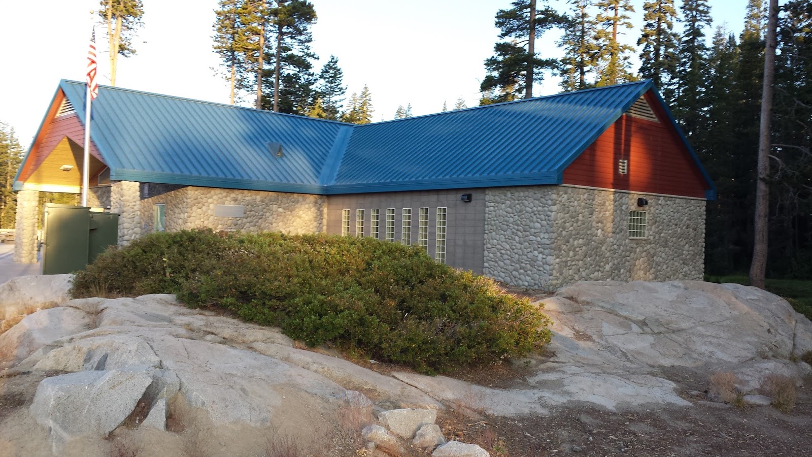
Building at the I-80 rest area where I started.


Where the trail goes under I-80.

The trail next to large granite boulders near Donner's Summit

Donner's Lake

Donner's Pass -- where people ate people.

The Sierras to the West.

The PCT followed the ridge line for most of the first 2.5 days.

Camp on Day 1

The ski lift just above my campsite on Day 1.

View of Lake Tahoe early in the morning from Camp #1.

A trash can with "hiker trash talk" written on it.
This was on the edge of the ski resort and the trash was probably from skiers.

The trail on the Squaw Valley Ski resort edge and along the Ridge.

Camp site day 2.

View of lake tahoe in the morning from Camp site #2.

My fashionable belt / purse strap.

Barker Pass -- with an outhouse...Yahoo!!!!

A giant mushroom.  Note my backpack for size comparison.

Lake Richardson.

Middle Velma Lake.

Middle Velma Lake.

Middle Velma Lake.

Campsite at Middle Velma Lake.

Middle Velma Lake in the morning.

Middle Velma Lake in the morning.

My Shadow.

Champlain Lake (south and higher than M. Velma Lake).

From Dick's Pass looking down (north) at all the lakes.

Dick's Pass.

A view from Dick's Pass looking south.

Lake Aloha.

Lake Aloha.  It was pretty barren.
Almost desert like with the sun reflecting off the granite and no shade.

Coming over the pass looking down at upper Echo and Echo Lakes.

The dam at Echo Lake.

Echo Chalet at Echo Lake.  Milkshakes....mmmmmm.

I took this photo of area 51 driving back through Nevada.
If you look at the enlarged version of this photo you will see a drone.


Saturday, May 18, 2013

Mile 374 to 386

Section D
Gary, Chris, Myself & Marvin at the Summit of Baden-Powell

Vincent Gap (Mt. Baden-Powell) to Islip Saddle – Nobo

Miles: 12 
Hiking with: Tennis Friend Dan C., Health Club Friend Marvin D., Father-in-Law Gary, & my son Chris.

Lodging:  We spent the night at the Cajon Pass Best Western.

Shuttle: A Dual Sport Bike (Kawasaki 250) that I put on the back of my Excursion & shuttle myself!!!

Dining: We ate at the Fisherman's Market in Banning on the way in and at the Grizzley Cafe in Wrightwood.

Start:  Vincent Gap.  The PCT crosses the road at this point.

End:  Islip Saddle.  The PCT crosses the road at this point.

People along the trail: About 40 -- a record!!!  This included about 10 through hikers.

Description: We left Phoenix Friday mid afternoon and stopped in Banning at the Fisherman's Market for dinner -- they just about know my name by now.  We spent the night at the Cajon Pass Best Western.  I was rather surprised the manager said they do about 15 thru hiker rooms a night.  They even had a food dump/share box for hikers at breakfast.  Most of the thru hikers I talked mailed their packages to Wrightwood....which is 3.6 miles and 2,400' elevation drop detour to pick up their packages.

Saturday we drove up to Vincent Gap where I dropped of everyone & took some pics then I drove onto Islip Saddle, parked the car and drove my motorbike back to Vincent Gap.  Everyone started hiking when I dropped them off except my son Chris.  Chris is a quick strong hiker and we caught up with the other after 1-1/2 hours.  The trail is consistently steep the whole way up with pine trees shading you all the way.  I can see why this is such a popular local hike.  At the top there was a monument to Lord Baden-Powell....founder of the Boy Scouts of America (and also the first census taker of India to include all classes of people).  The hike down also had a moderate amount of shade but it was a cool day so even with the sun shining we never go hot.  The up was about 4 miles and the down 8 miles.  If I lived in the LA area I would make this a regular hike -- a great workout.  We decided to return home early on Sunday and so I deferred my hike planned on Sunday.

Dan C. with a thru hiker.

The Crew -- Dan C., Myself, Chris & Marvin.

Chris just starting up the trail.

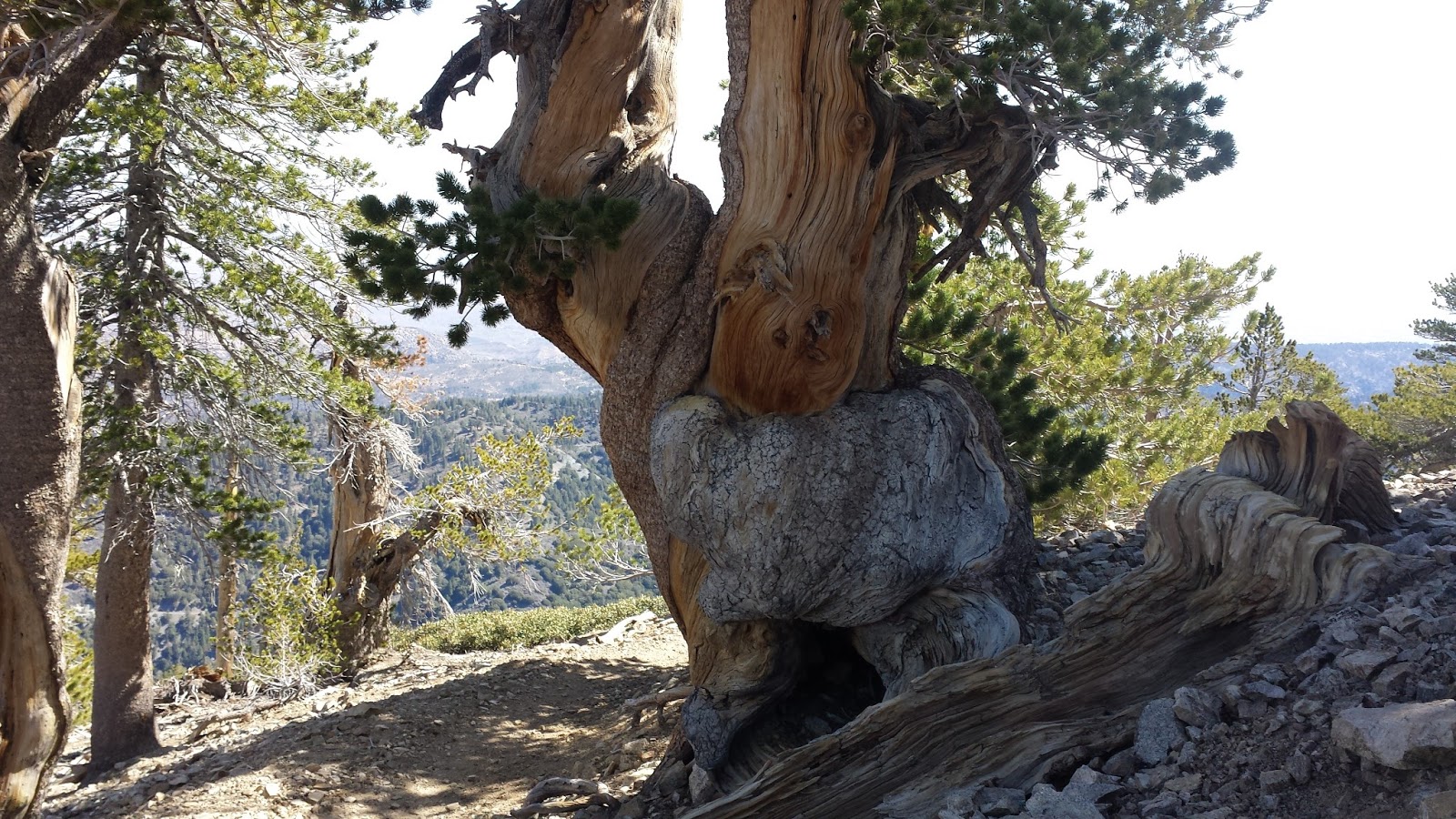
A gnarly tree along the path.

Wow -- a patch of snow close to the summit.

Junction sign about 1/2 from the top.

Gary, Chris, & Myself at the Summit.


Dan C. resting on the Baden-Powell monument.

Trail graffiti on the way down.

Chris.

Gary and Dan C. on the final descent to Islip Saddle.

Yahoo -- mission accomplished!!!