|
| A view east from the ridge line looking at the desert floor. |
Section G
Horseshoe Meadow to Kennedy Meadows Campground – Sobo
Miles: 41 (43 including 2 miles to get the PCT from Horseshoe Meadows)
Hiking with: Solo
Lodging: Comfort Inn, Lone Pine, CA. I was shocked that the city of Lone Pine was pretty much sold out on a Thursday night at the end of September -- I paid about $110 for a mediocre room.
Shuttle: A Dual Sport Bike (Kawasaki 250) that I put on the back of my Excursion & shuttle myself!!!
Dining: I got a hot dog from the gas station up the street in Lone Pine before I went to bed. I haven't found any good restaurants in Lone Pine (although I haven't searched very hard).
Start: Horseshoe Meadows. I took Trail Pass Trail (2 miles) to the PCT.
End: Kennedy Meadows Campground. The PCT enters the campground at the north end next to a couple of out houses and a small paved parking lot.
People along the trail: Absolutely no one.
Description: I left Phoenix at 6 am Thursday morning and got to the Kennedy Meadows Campground by 3 pm. I was surprised how steep and long the road was from the desert floor just outside of Crestview, CA up to Kennedy Meadows. I was also surprised how few peoplevehicles I saw. There was no one at the campground -- I thought I would at least see 1 or 2 RVs. I found where the PCT enters the campground on the north side and parked my Excursion in a parking lot right next to it. There were signs about paying fees for camping and I just ignored them. I figured it was so late in the year that they wouldn't check. I unloaded my motor bike, put on my backpack and rode back down to the desert floor and then up to Lone Pine (1.5 hours). My motorbike and OK for 20-30 minute rides but for 1.5 hrs. its was loud and vibrated a lot. I went 60-65 mph but still had semis passing me on a regular basis. I got to the Ranger Station in Lone Pine just as they were closing -- I was the last one they let in -- and I got my wilderness permit (free). The ranger warned my that most of the water sources were dry because it was a very light snow year and it was so late in the season. At the time I thought he was being too cautious -- hmmmm. I spent that night at the Comfort Inn in Lone Pine.
The next morning I was up at 6 am (it got light at 6:30am), ate breakfast at the hotel and was on my bike headed up to Horseshoe meadows by 6:30 am. It wasn't too cold in Lone Pine by by the time I got to Horseshoe Meadows (9,500' elevation) I was freezing. The cars in the parking lot were covered in frost. I parked by motor bike and chained the wheels and frame and headed up the Trail Pass Trail to the PCT at 7:30 am.
The trail was typical PCT as it followed the ridge line with great views of the Sierra Mountains to the west. A couple of times it popped out on the east side of the ridge with spectacular views of the desert floor 10,000' in elevation below. I first stopped to get water at Diaz Creek. Although I thought I had enough to make it another 6 miles to what I though was a dependable spring I remembered what the ranger told me and decided to be safe and get some more water. Diaz Creek is about 200 yds off the PCT (I'm a lazy hiker -- I never like to add additional mileage to get water or camp far from the trail). It is a small creek about 2 feet wide and 4" deep. There were cattle tracks in the sand up and down the creek. I decided to filter some just in case -- I could always throw it out and replace it with better water later. This was the best water I saw for the next 24 hours!!!
I hiked on to where I though I was going to camp at mile 736 but when I got there I decided to continue on to what I thought would be better water at a lower elevation (hence warmer too). 5 miles later I came upon the spring/campsite at mile 731 -- it was a small stagnant pond covered with orange algae. Yuck!!!! I was low on water but scooped out a liter of algae filled water as a back up and hiked on to the next water source.
3 miles later I arrived at what I had read from another hiker as "always good water" at mile 728. It had the same orange algae as the previous water source but there was a trickle of flowing clear water. Beggars cannot be choosy. This was good enough for me. I filtered the water and it still had a slight orange hue to it with a slight taste but not too bad. Tired after a long 20 mile day I set up camp, ate dinner and was asleep by 8 pm.
The next morning I rose slightly before sun up and started breaking camp and fixing breakfast. It was a very quiet night -- no animals (probably because water was so scarce). I was on the trail by 7:30 am. I started out with a climb and then thought there would be another water source in a couple hours so I only carried 2 liters.
All the water sources on the maps were dry. When I got to the "dependable" water source in Bear Trap Meadow it was also dry. Fortunately there was a spring about 1 mile south of miles 722 that was right next to the trail. I filtered and was ready to go.
After the trail junction with Olancha Pass the trail follows a cattle trail. At about mile 720 I followed the cattle trail with left the PCT for about 200 yards but fortunately I was checking my phone/GPS regularly around trail junctions and saw that I was off the trail. I traversed 1/2 way down a hillside and looked for the trail and didn't see it so I hike back up to the cattle trail assuming my GPS was wrong. Looking at my GPS I could tell I was definitely off the trail and after hiking about 600 miles of the PCT following HalfMile's GPS track he has never been off so I hiked back down the trail -- this time all the way to the bottom where I found the PCT again!
Once again I soon was running low on water when I finally saw the Kern River at mile 716 in an open field. On the map it looked "significant" but after all the dry water sources I was shocked how big it was (20' wide and 2' deep). There is a bridge over the river which always looks impressive in the middle of the wilderness. Once again I filtered some water but only a couple of liters as there were now water sources more frequently -- so I thought.
Once again the water sources were dry -- I figured I had only 1 liter left and I had about 6 miles to go. I was going to camp at mile 710 but I thought that I would just consume my remaining liter during the night and would have to hike the rest of the way without any water. I decided to just forge ahead and finish the hike that day and ration the last of my water over the last 6 miles.
My some miracle even though all the springs in the area were dry I came upon an unmarked spring about miles 708 and was able to re-hydrate. At this point I had hiked about 20 miles and could have spent the night but this area had been scorched by a forest fire and was very barren so I hiked on to Kennedy Meadows.
At mile 707 there is another bridge over the Kern River in a canyon. Campers hike up here from Kennedy Meadows campground to swim in the pools created by large granite boulders in the Kern River....It's pretty spectacular. I still haven't seen any one since I left Horseshoe Meadows and I expected the campground to be empty but to my surprise it was just about full!!! I arrived about 6 pm and my Excursion was still there, I hopped in and drove to a water spigot and took a sponge bath and drove out of the campground.
Section hiking the PCT there are things that I do that through hikers don't and vice versa. Everyone always talked about the store at Kennedy Meadows so I decided to take a slight detour stop in and grab something to munch on. There were about 12 cars in the parking lot with people in their camping chairs visiting with each other, eating and basically having a good time. The store was closed but it looked like one of the groups of people were selling food so I went over and asked if I could have some -- they said it was cold but I they still had some. I grabbed a paper plate and they served me meat loaf and beans from 2 dutch ovens. I asked if they had any soda -- they pointed to a cooler, I grabbed one and asked what do I owe them. They said nothing -- the whole gathering was just the residents of Kennedy Meadows and they were happy to share. I was rather shocked, kindly thanked them and headed on my way.
I drove 2 hours to Horseshoe Meadows where I slept in the parking lot in the back of my Excursion. The next morning I loaded up my motor bike and headed down to Lone Pine and ate breakfast at the Mount Whitney Restaurant -- excellent biscuits and gravy!!!
 |
Horseshoe Meadows at the trail head.
Shadow (me), my pack and my motor bike. It was cold!!! |
 |
| A sign at the trail junction of Mulkey Pass and the PCT. |
 |
| Rocks along the PCT. |
 |
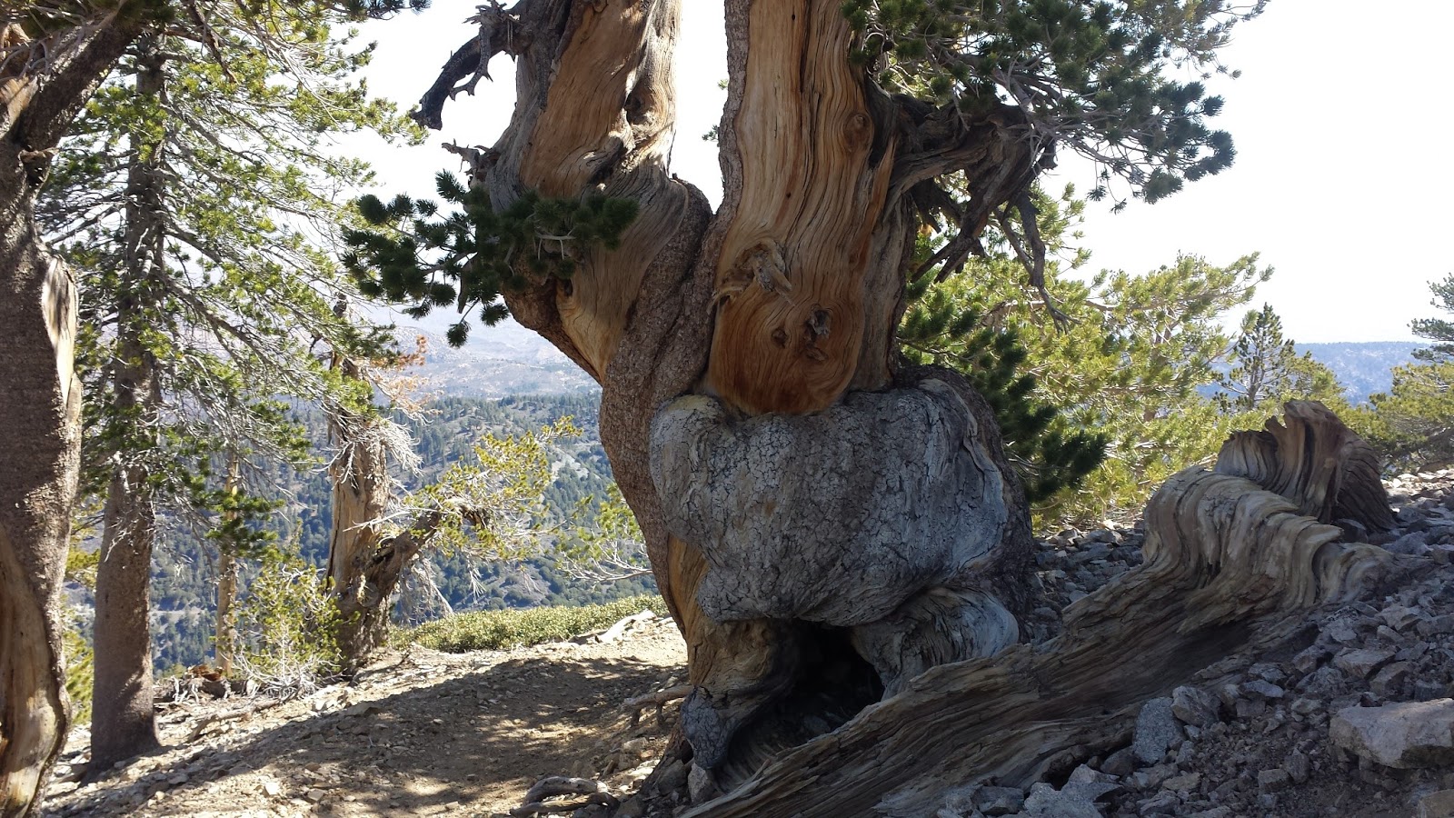
There were a lot of dead trees (from wind and snow),
but they were very colorful. |
 |
| Typical few of the first 10 miles -- Pine trees with very little ground vegetation. |
 |
| A view to the west of the Sierras. |
 |
A sign along the trail at mile 736 indicating a spring off trail.
I should have gotten some. |
 |
| The PCT along the ridge line went between this rock formation. |
 |
A view to the west of the desert floor.
This was much more spectacular in person than what the photo shows. |
 |
| Water taken from the stagnant pond with orange algae at mile 731. |
 |
| The PCT crossing a meadow at about mile 729. |
 |
| The good stream I got water to filter from at my campsite. |
 |
| My campsite at mile 728. |
 |
| Oh rip!!! I never saw anyone on the hike so who cares? |
 |
| Cattle trail after Olancha Pass Junction. |
 |
| PCT Sign along the trail. |
 |
A view of the Kern River.
(technically the south fork of the Kern River) |
 |
| The bridge over the Kern River looking east. |
 |
| A burnt forest about mile 710. |
 |
| The bridge crossing the Kern River at mile 707. |
 |
| A view looking down at the Kern River from the bridge. |
 |
| Sunset as I was driving out of Kennedy Meadows. |
 |
Sunrise after picking up my Motorbike at
Horseshoe Meadows and heading back to Phoenix. |
 |
Driving down from the Sierras from is the shadow
of my Excursion and motorbike. |
 |
This is a painted rock (Godzilla) on the
Whitney Portal Road just out of Lone Pine, CA. |