Sunday, May 27, 2012

Mile 347 to 356


Looking north into Lone Pine Canyon.

Section D
Lone Pine Canyon Rd to Gobbler's Knob – Sobo

Miles: 9
Hiking with: Chris


Lodging:  Best Western Cajon Pass, Cajon Pass, CA – This hotel has the easiest access to Wrightwood and the Eastern Part of Section D.  It's right next to the highway and still pretty quite.  There is only a subway  and McDonalds for food in the area unless you want to travel 20 minutes north to Hesperia where there is a mall and all kinds of restaurants.


Shuttle: A Dual Sport Bike (Kawasaki 250) that I put on the back of my Excursion & shuttle myself!!!

Dining: We ate the previous night in Wrightwood at the Grizzley Cafe. We had a burger -- pretty good.  I have since talked with a Wrightwood resident who claimed that all the restaurants in Wrightwood are respectable...nothing outstanding & nothing you need to avoid.

Start:  Sheep Creek Truck Trail (or Lytle Creek Rd) off of Lone Pine Canyon Road.  This is a pretty rough road that is closed in the winter.  I was fine in my 2 wheel drive Excursion -- but it was bumpy, rocky and slow going.

End:  Swarthout Canyon Road off of Lone Pine Canyon Road.  I parked my motor bike about 1/8 north of where the PCT crosses this road behind a hill...it was pretty well out of sight.

People along the trail: We saw 2 groups of PCT through hikers going north.  It's always inspiring when you cross paths with these hikers.


Description: Other than the bad dirt road to the trail head this was a great 9 mile section with great views down to the Lone Pine Canyon.   There was a lot of Poodle Dog Bush in the area (we were in shorts) but we were always able to go around it or step over it.
The Shuttle Bike parked at Swarthout Canyon Road.

The Trail the beginning.

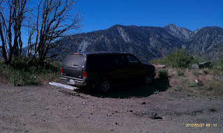
The Excursion parked at Lytle Creek Road.

Indian Paint Brush.

A view west up Lone Pine Canyon.

A view north towards Hesperia (I-15 is visible).

A view down where Lytle Creek Road meets Lone Pine Canyon Rd.


Poodle Dog Bush -- avoid!!!!


Chris where the PCT crosses Swarthout Canyon Road.

Saturday, May 26, 2012

Mile 369 to 374


Clounds blowing over the mountain ridge
near Inpiration Point.
Section D
Inspiration Point to Vincent Gap – Sobo

Miles: 5
Hiking with: Chris


Lodging:  Best Western Cajon Pass, Cajon Pass, CA – This hotel has the easiest access to Wrightwood and the Eastern Part of Section D.  It's right next to the highway and still pretty quite.  There is only a subway  and McDonalds for food in the area unless you want to travel 20 minutes north to Hesperia where there is a mall and all kinds of restaurants.


Shuttle: A Dual Sport Bike (Kawasaki 250) that I put on the back of my Excursion & shuttle myself!!!

Dining: Friday night we got in rather late so we didn't eat anywhere.

Start: Vincent Gap Trail head just off of Hwy 2 (Angeles Crest Hwy).  This is also the trail head to go up Mount Baden Powell...it was fairly empty when we were there but I hear it can get pretty full as the Mount Baden Powell hike is very popular.

End: Inspiration Point off of Hwy 2 (Angeles Crest Hwy).  This trail head is on the north side of the road.

People along the trail: We saw a couple pushing their baby in a stroller close to Grassy Campground...go figure.  There were also some campers at the Grassy Campground which looks like a great place to camp.


Description: I have been having lower back pain recently so I decided to do a short hike to see how much pain would result from hiking.  This hike fit the bill as it was relatively short.  We got up in the morning an it was extremely cold (low 40s) and we assumed it would be in the 30s in the mountains.  Being good desert dwellers we planned on hiking in shorts & t-shirts so we drove up to the Kohl's in Hesperia and bought some sweat shirts and got breakfast at McDonalds.  It was so cold that we decided to hit an 11am movie before the hike too.  We finally got on the trail after 3 pm....it was still cold.  The clouds were hoovering the mountain ridges and the wind was still blowing from time to time.
Chris at the Vincent Gap Trail Head.

The trail.

A view north of the Mohave Desert -- the south side of the mountain
ridge was packed with clouds.


Grassy Hollow Camp Ground

There were many wind swept trees along the hike.